Active filter
- Search for "tourist information bollendorf"
- Sort by "Best results"


Tourist Information Bollendorf
Bollendorf
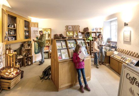
Up-to-date information in 290 year old rooms - the Tourist Information Bollendorf invites you to get detailed information about the Felsenland Südeifel.
More information
Bollendorf Fairytale Trail
Lenght: 3.3 km
Route: below the forest sports ground "Gärtchen", Bollendorf to below the forest sports ground "Gärtchen", Bollendorf
Difficulty: medium
Family-friendly

Natur- und Kulturschätze der Bollendorfer Felsenwelt entdecken
Bollendorf
We go on a "listening tour" and let ourselves be acoustically guided through the varied rocky landscape around Bollendorf. Interesting information on nature and culture awaits us.
More information
Tourist information points
More information
Audiotour "Bollendorfer Felsentour mit Manfred"
Lenght: 9.6 km
Route: Tourist Information in the Abbey courtyard, Neuerburgerstraße 6, 54669 Bollendorf to Tourist Information in the Abbey courtyard, Neuerburgerstraße 6, 54669 Bollendorf
Difficulty: medium
Round trip

Rocks, gorges and magical forests
More information
Cycling through river valleys
More information
E-Bike Ladestation Abteihof Bollendorf
Bollendorf
The charging station is located directly in front of the Tourist Information in Bollendorf, just a stone's throw from the Sûre cycle path.
More information
Angeln an den Grenzgewässern Sauer, Our und Mosel
Bollendorf
Border water permits for Sauer, Our and Mosel are available at the Tourist Information Bollendorf and at the administration of the South Eifel Association (Verbandsgemeindeverwaltung Südeifel) in Irrel.
More information
Bildcheslay
Bollendorf
A rock as a former place of worship for Bollendorf quarry workers.
More information
